Bayside Middle School, interactive 3D model
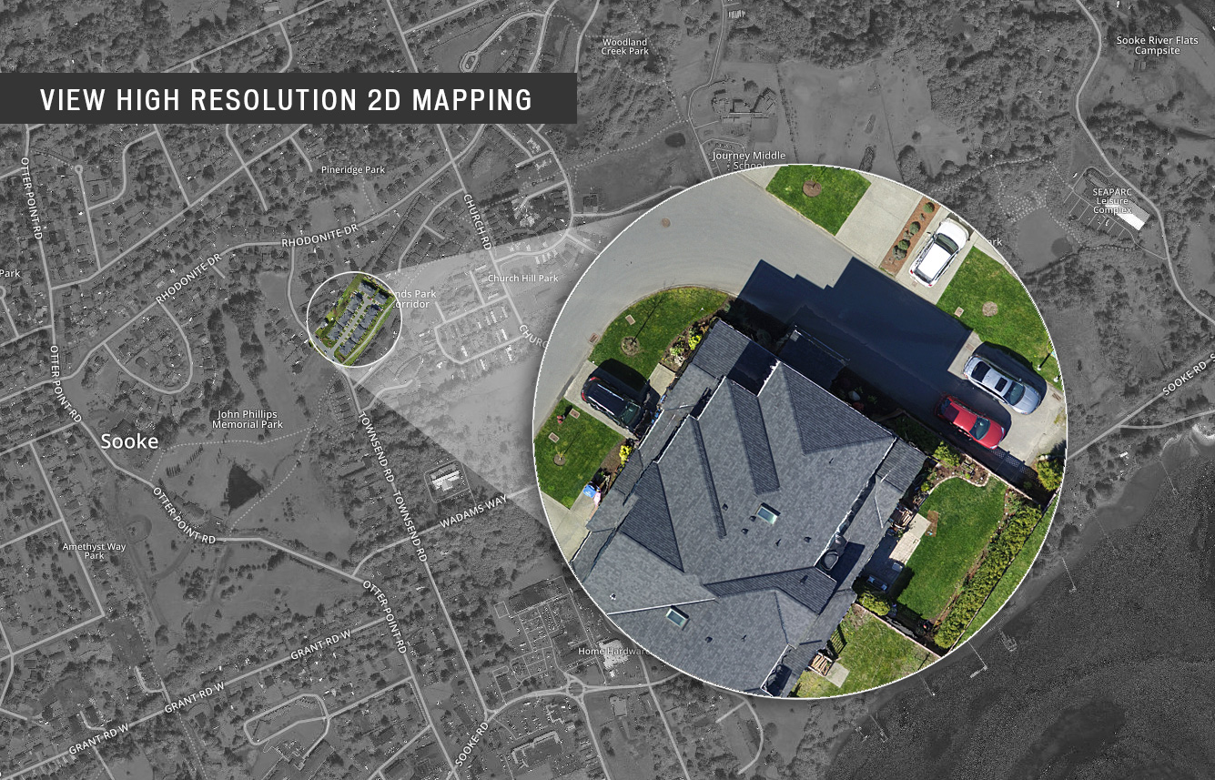
2D MAPPING
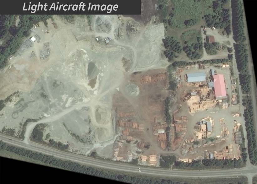
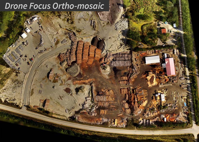
Unmanned air vehicles (UAVs) offer a number of significant befits when compared to manned aircraft, and satellite images.
Benefits include:
- Lower operating cost
- Flying at a much lower altitude and producing greater image detail
- More flexibility - flights can be scheduled as often as required, targeting even the smallest area's
- Lower environmental impact (Drone Focus UAVs use electric motors)
- Ability to recreate exact flight patterns any number of times - crucial to tracking changes
- Keeping your personnel out of harms way
3D MAPPING
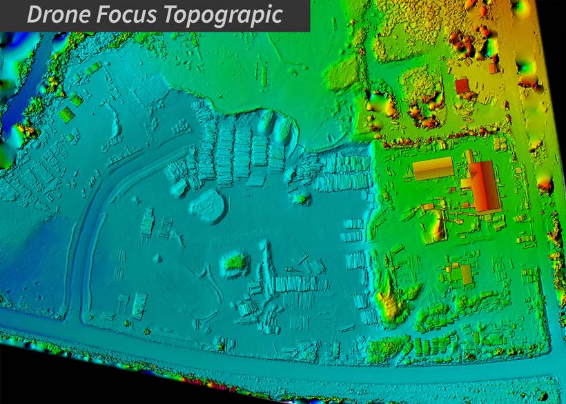
We use the most cutting-edge methods available for creating our maps. Combining multiple looks at an area as our UAV flies over allows us to create a 3D model from which you can derive stunningly accurate orthophoto maps. The textured 3D model can be downloaded and previewed online.
We can provide you with raw data or manipulate the data for better use and understanding.
Technical outputs include:
- Digital Elevation Models (DEMs)
- Textured 3D Models
- 3D KMZ
- Full resolution JPG
- Full resolution TIF/GeoTIFF files